
We Hiked Vulcan Pacaya, the Beautiful Volcano in Guatemala
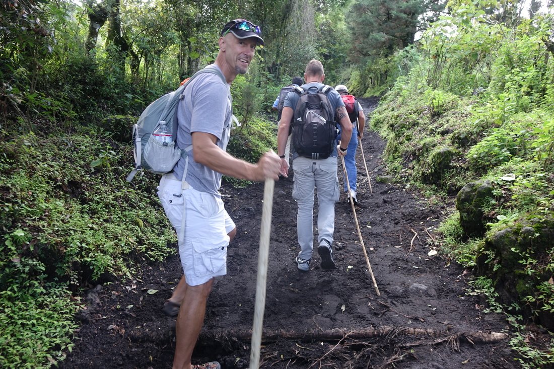
Here we go! The early part of the hike up Pacaya Volcano in Guatemala is very steep, making walking sticks valuable.
More than 30 volcanoes rise within Guatemala's highlands, making these unpredictable cratered peaks a highlight for travelers who seek out the challenge of scaling the steep trails up to take pictures of the gray giants that stand out in the mountainous landscape.
In fact, Guatemala has the highest density of active volcanoes on Earth because it sits within the Ring of Fire. The most well-known volcanoes, Agua, Fuego and Acatenango, loom above the historic old capital city of Antigua.
On our first trip to Guatemala, we made it part of our plans to get out to see one of these bad boys. We took a day to hike up Pacaya Volcano, which is one of the country's most-active volcanoes and has been in a constant state of eruption for more than a year. This sounds worse than it looks up close, as you will see small plumes of gas and ash drifting from the top of the volcano. Pacaya's last major eruption with large lava flows and widespread damage was in 2010.
Pacaya Volcano National Park is located in the town of San Vicente Pacaya, about 30 miles from Guatemala City. The hike starts at 5,750 feet above sea level.

A glimpse at the peak of Pacaya Volcano.
The well-marked path is quite steep during the first portions and slippery throughout because of dampness and loose lava rock. Children of the village will offer you a sturdy walking stick to rent for $1 for your adventure. If you grab one of the sticks, you'll make the day for one of these smiling, persistent and enterprising young people. Your knees might also be grateful for the assistance of added stability and balance during the hike. Horsemen also are available for a fee to guide you on the trail on horseback.
The hike was a good workout. We shunned the horsepower and enjoyed a healthy sweat in the warm and humid conditions. Along the way, we spotted tiny farm plots filled with beans, corn and squash thriving in the rich volcanic soil.

Horse taxis are available, but our crew just welcomed them as friendly companions on the hike.
Once we reached the base of the main cone at 8,400 feet, we witnessed the peak intermittently shrouded in clouds that rolled past. The crater emits a glow at night. From there, we ventured into the massive volcano complex and explored the lava field, walking across the sharp and craggy rocks, with a stop to pierce a few marshmallows with a long stick and toast them from the heat venting from hot lava hidden beneath the hardened surface rocks.
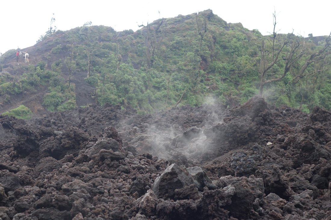
Steam rises from a vent in the lava field.
The sweet treats were a tasty reward and good energy source to help us finish the challenging hike. It was over the top and down the other side, now, snaking our way through a haunting mist that shrouded the mountain in the early afternoon.
If you go, local operators will charge about $15 and up for a tour.
Thanks for reading.
Travel fit! Travel happy!
JR